- This list includes only walks we have a record of.
We have maps for them in:
- Google Earth held by John - as a file (kml)
- Google Earth held by John - within GE, no KML (ge)
- JPEG files held by John (a lot ex Alan M) (jpg)
- Paper maps held by John (jg)
- Paper maps held by Mike B, mostly undated Rambles. (mb)
- 37 without maps.
Ask for a copy.
Routes more than 6.3 miles have the miles in RED.
The old limits were 6 to 7 miles, since 2023 walks should be 5.5 to 6.25 miles.
Zero miles means unknown.
'Distance' is miles from BBH to the pub, where known.
Pubs in
RED have closed,
BLUE no longer do Wednesday lunches,
'$$' indicates too expensive.
Tell us if you know of changes.
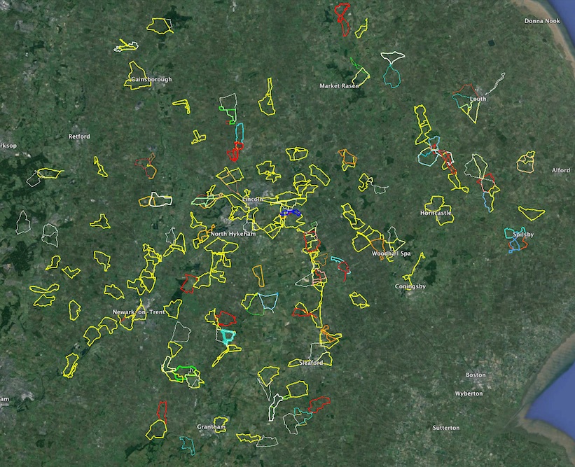
Click on a place, that is highlighted as a link, to show it on OpenStreetMap.
It's just the start not the track, normally the pub location.
Space on the website does not allow us to store related track files,
but just email one of us and we'll send them.
OpenStreetMap is a detailed free resource which also shows public
footpaths.
|
click to enlarge
|